5 INTERESTING THINGS ABOUT THE TREKKING ROUTE: TA NANG – PHAN DUNG
To have a better picture of the Ta Nang-Phan Dung trekking route, the most beautiful route in the South in this legend, let’s find out with Hong Ngoc Ha Travel through the very vivid notes of Mr. Tran Dai below.
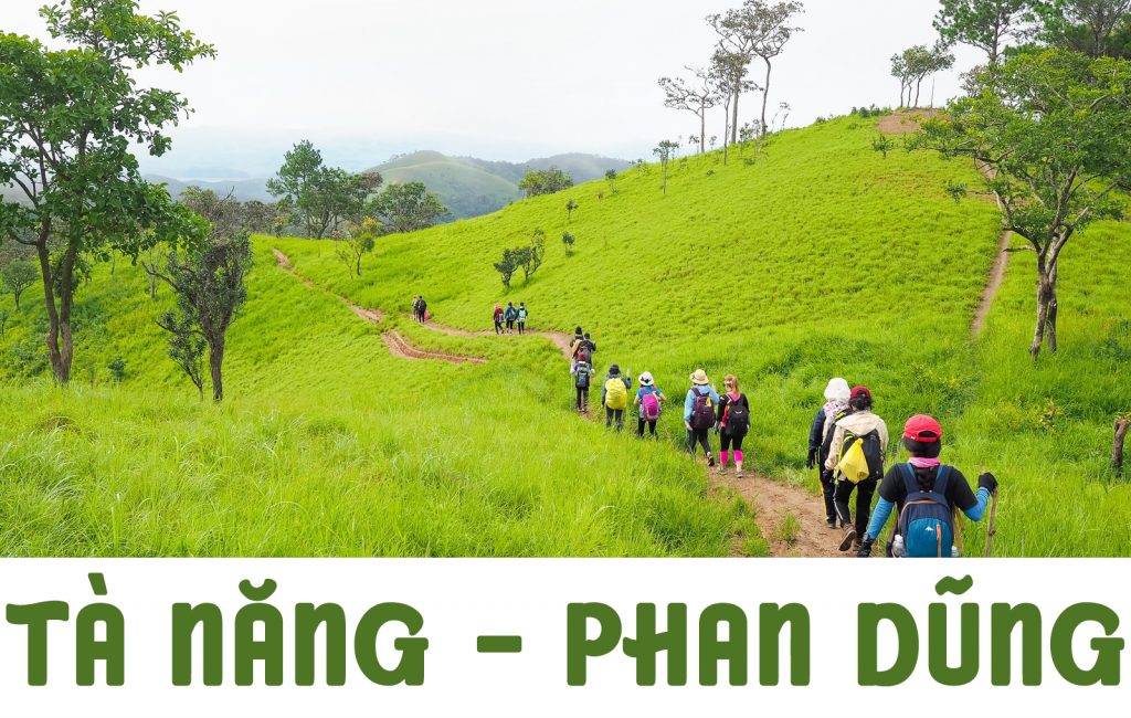
About 300km from Ho Chi Minh City, Ta Nang-Phan Dung is a road of more than 50 km in the territory of three provinces: Lam Dong, Ninh Thuan, and Binh Thuan. Diverse vegetation, majestic scenery, and moderate difficulty make this route suitable for trekking with people of many ages. Ta Nang side is a beautiful road with trees growing on both sides of the road. The slope is not too high. As for Phan Dung (towards Yavly waterfall), the road is quite slippery, zigzag, with many slopes. The trees are mainly pine. At the top of Ta Nang, in the evening, the dew falls quite thick and fast. The wind is especially strong in the middle of the night. With a journey of two days and one night, Ta Nang-Phan Dung is a road that challenges those who love to experience it. After two days of exploring Ta Nang-Phan Dung trekking, you will fully enjoy the taste of the mountains and forests with the immense green of the mountains, the cold bit of the Central Highlands winds, and the orange-red color of the burning grass hills, the starry sky above the tent, and the feelings of companions. And above all, the courage to push yourself beyond your limits.
We have an unforgettable experience beginning in Ta Nang commune, Duc Trong district, Lam Dong and continuing through Phan Dung commune, Tuy Phong district, Binh Thuan.We leave Ho Chi Minh City at 19:00 for San Homestay, a Tay ethnic community on the outskirts of the Ta Nang forest, to rest and enjoy the peaceful atmosphere of the highlands before our trekking day. The next morning, before entering the forest, we had a wonderful breakfast in the warm early morning sun. The omelet, hot bread and green vegetables grown by the owner herself in the garden are ready.
Day 1: A challenging 15-kilometer walking
In the morning, the tour guide disseminates safety rules for the journey and details about the distance, climate, terrain, etc. Each person is given a cane, a raincoat, and a water bottle.
The starting point of the trek is a rice field of the Churu people. The Churu follow the matrilineal system, so the husband has to stay in-law and cannot own property, so the fellow guy that the crew hires wants to go to work must also ask his wife’s permission to go. The boys in the group were all interested in this culture, and the boys thought to themselves how lucky they were.
Continuing along the way are the cool three-leaf pine forests. People began to enjoy listening to the sound of the pines’ ringing in the wind. After 6 km of the first flat road and a few small murmuring streams, the beginning of the steep climb
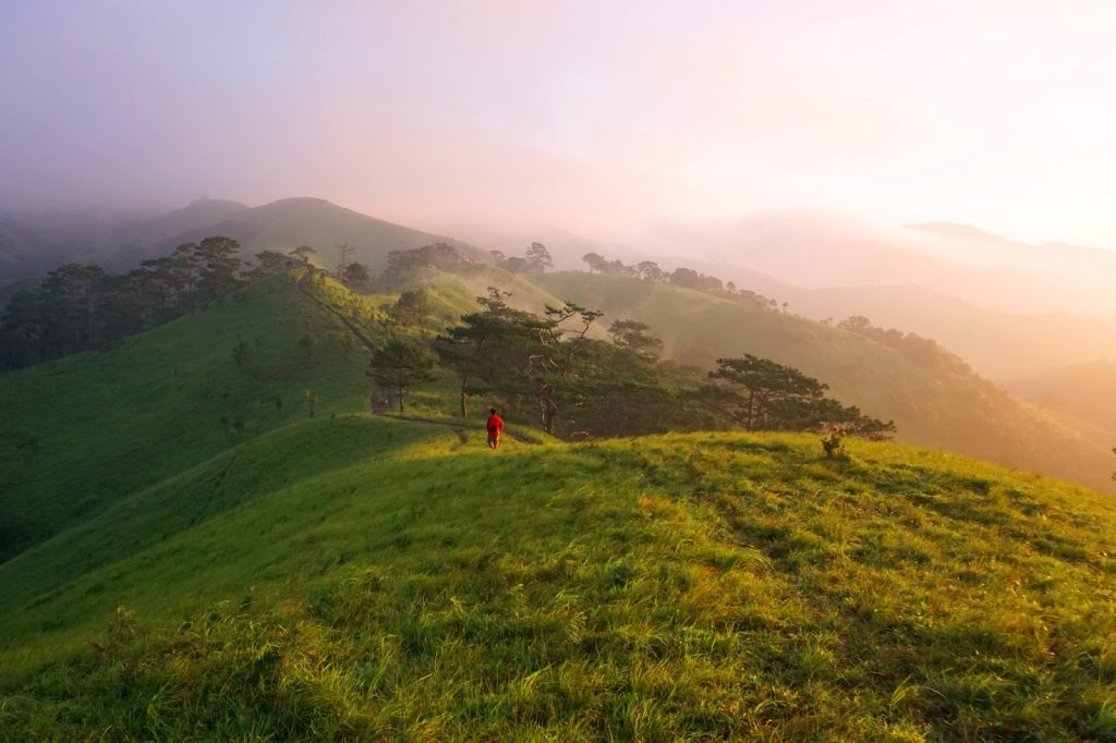
The slopes here are not too harsh, but they go on forever. The whole group keeps wondering when the slope will end. However, the reward began to appear when we reached the first grass hill. A majestic natural scene stretched out before us. The green grass hills were like a steppe in love with spring, the atmosphere, the fresh air of the plateau and the cool breezes, alleviating a lot of the previous hardships.
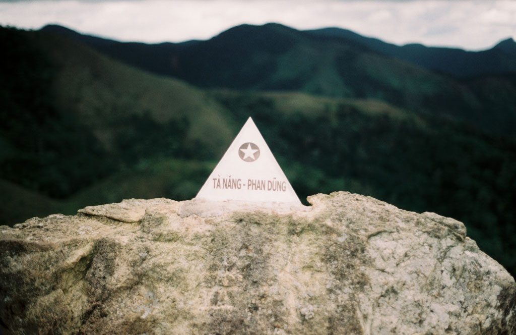
We set foot on the territory of Phan Dung commune, where there is a stainless steel spire marking the boundary coordinates of the two provinces of Lam Dong and Binh Thuan. From here you can see the highest mountain in the area, named Hon Dien by the French.
Rumor has it that there was once a tiger on the mountain with a cut and three legs, so the foresters did not dare cross that area. From the border of the two provinces, there will be two directions towards Phan Dung. If you go straight to Soldier Hill, it will take 2 days and 1 night. If you turn left, it will take 3 days and 2 nights to get to Yavly waterfall.
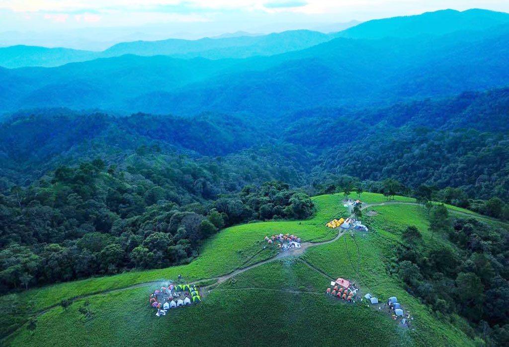
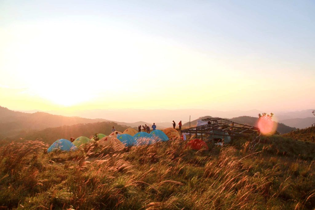
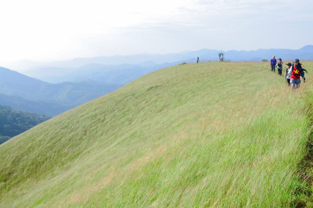
At 16:00, the group arrived at the campsite, which is on Hai Cay Thong hill, which is a hill about 900m above sea level and has a very wide view. Most trekking groups camp here. That evening, the whole group had dinner, shared and sang in the peaceful atmosphere of the wild mountains and forests, ending the day with a glass of fragrant sticky rice wine. Everyone goes to bed early to have the strength to wake up in the morning to catch the sunrise on the plateau.
Day 2: Complete another 15km
To reach the finish line, we started to lower the altitude from 900m to 400m. The guide showed us the elevation change by observing the difference in the landscape from temperate coniferous forest to mixed broadleaf-coniferous forest, to grasslands, and finally deciduous forest, also known as dipterocarp forest, which is extremely harsh here in the dry season because most of the streams will be dry. If lost, it will be difficult to find water.
The forests of the Dauaceae family began to appear dense, with the characteristic of extremely thick bark to be able to resist the harsh sun of northern Binh Thuan. In the past, the Cham people used the sap of the Diu tree to waterproof boats, fuel, and make mortar for the bricks of the Cham towers. After the continuous downhill, we took a break for lunch at a small stream, closed our eyes and listened to the sound of birds chirping, then opened our eyes to see nature.
Continuing to walk in the forest until 14:00, the last stretch of the forest landscape was no longer beautiful. The motorbike taxi park of the Raglai people was in front of us. We thought of the song “Chapi Dream” by musician Tran Tien. It turns out to be about the lovely boys who were right in front of my eyes. In order to create more income for the locals, we decided to take a motorbike taxi to Phan Dung commune (5km).
Everyone is tired, but everyone wants to stop and look at this beautiful road for a while.Going to places like this, I realized: “You don’t have to go anywhere like abroad; Vietnam is so beautiful, so poetic, so proud of Vietnam”!
Things to note when trekking the Ta Nang-Phan Dung route
You should not arbitrarily plan to go to ensure your safety. You should choose a reputable tour organization to help ensure safety, tents, food and drink, and travel insurance.
The first important thing is psychological and health preparation. You will be in the forest for 2 to 3 days and there is almost no phone signal. The temperature drops very low in the evening, and the wind is always strong. Therefore, you should prepare warm clothes and sleeping bags and get used to self-sufficient personal hygiene in a forest.
Crossing the road more than 50 km on your own feet is the most important condition for you. To be healthy, you should engage in physical activity such as jogging, climbing stairs, …, at least one week before.
Always stick with your teammates; never separate from the group.
Do not go trekking at night.
Equip trekking shoes and a backpack with a power belt for more comfortable walking. The better to prepare with warm enough, water-resistant clothes, the better. Long pants and sleeves help you avoid squeezing insects, rubbing against plants, etc.
Trekking is like any other type of tourism; you should always prepare well, especially with some basic survival skills.